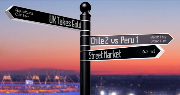
What if street signs knew where we wanted to go? What if they could even point us in the right direction?
Brooklyn-based design agency, BREAKFAST, has somehow figured it out. In the past three years, they have been busy developing this urban “wayfinding” sign; an urban intervention that has finally caught up with us technologically.
So Breakfast created Points; a new, smart, rotating, digital sign that adjusts itself according to what you’re looking for, what’s happening around you, and the time of day. This is done by compiling geo-tagged data via RSS, twitter, foursquare, local businesses/events.
“We started BREAKFAST with the intention of creating entirely new products that harness the power of the web, and in turn, change how people interact with it in the real world. Points is the culmination of that idea.” – BREAKFAST
Naturally, city streets and public spaces are ideal for these smart signs as they can orientate pedestrians and notify us of emergencies, weather conditions and nearby events. They can also be used to navigate transit with access to nearest bus routes, subways, and bike-share stations.
While a city is the instinctive setting, the technology is adaptable to conference settings, sporting events, and music festivals, to name a few.
Are Canadians ready for Points to guide us through the city?
Via FastCoCreate and Breakfast/Points
Urban Planet is a roundup of blogs from around the world dealing specifically with urban environments. For more stories from around the planet, check out Spacing on Facebook and Twitter.
The post “Points”: The most advanced sign on earth appeared first on Spacing National.